About
The 454-hectare (1,122-acre) Malcolm Bluff Shores property is located on the Niagara Escarpment on the north shore of Colpoys Bay, an embayment of Georgian Bay, and includes four kilometres of undeveloped Great Lakes shingle beach shoreline as well as an unbroken expanse of forested land. The Bruce Trail crosses the property, running along the top of the escarpment. The views from the trail looking out across Georgian Bay are spectacular.
The Malcolm Bluff Shores property has an amazing physical diversity, with over 110 metres of elevation change from the beach to the highest point at the top of the escarpment. Six distinct geologic formations can be observed, as can wetlands, forests, talus slopes and vertical cliffs. Black bears, scarlet tanagers, ovenbirds, wood thrush, Canada warblers and peregrine falcons have been seen on the property, as have a number of rare fern species.
Malcolm Bluff Shores © Robert McCaw
Protection
In 2011, Ontario Nature and the Bruce Trail Conservancy joined forces to launch an ambitious initiative to save an ecologically important area from development. Many individuals, foundations and organizations gave generously in support of this effort.
Ovenbird © Robert McCaw
Visiting
Access to the lower portion of the property is at the end of Mallory Beach Road. From Wiarton head north on Highway 6 and turn right onto County Road 9. Turn right onto Mallory Beach road and follow it until the road ends. A small parking area is located at end of the road at the entrance to an old logging trail.
This is an official side trail to the Bruce Trail. This is a 4 km loop trail that will take you along the old logging road, and then down to the shoreline of Georgian Bay, as you make your way back to the Mallory Beach Road parking lot.
We do not charge a fee for entrance and there are no operating hours on any of our nature reserves. Properties are monitored by volunteer stewards. We rely on visitors to be safe, minimize their impact on nature and be respectful of others. For more information about visiting the reserves, please read our Permitted Activities Policy.
We welcome donations to support this nature reserve and our system of 26 nature reserves.
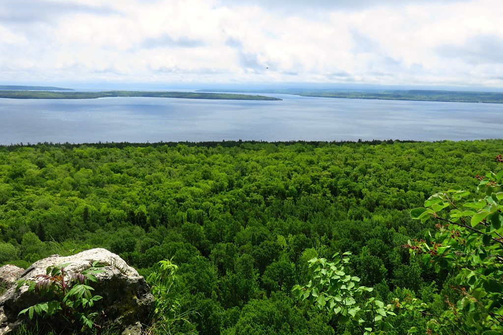
Lookout above Colpoys Bay © Anita Caveney
Directions
From the centre of Wiarton, follow Highway 6 north 3 km and turn right onto County Road 9. Follow County Road 9 for approximately 6.2 km, and turn right onto Purple Valley Road. Continue down Purple Valley Road for 5.2 km to an intersection where Purple Valley Road turns left. Continue straight through the intersection on Wright’s Crescent and follow for 2 km, where Wright’s Crescent takes a 90-degree bend to the left. Look for the Purple Valley Access trailhead on the right, at the bend.
A parking area is located on the right, just beyond the 90-degree bend. This trailhead is the entrance to the main section of the Bruce Trail that runs through the property.
View Malcolm Bluff Shores Nature Reserve in a larger map.
Mature forest, moss-covered boulders, lichen and ferns © Gabriella Zagorski
Peregrine falcon © shutterstock outdoorsman
Photo Gallery
The Malcolm Bluff Shores Nature Reserve is generously supported by:
The Comart
Foundation